Introduction to Galle Fort – Sri Lanka
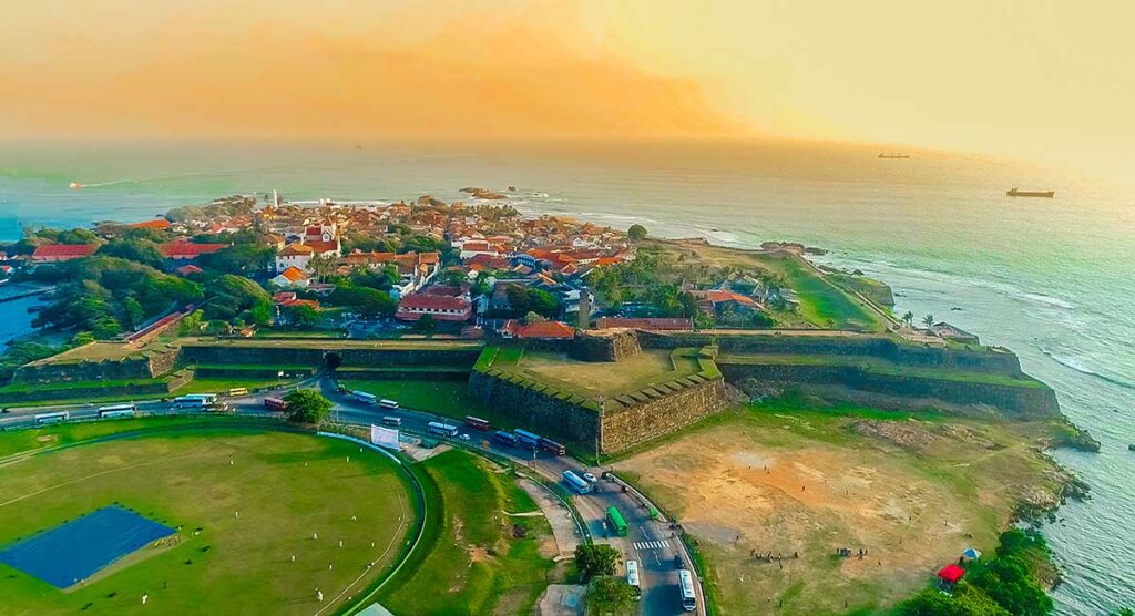
In the southwest coastal area of the island, there lies the famous bay of Galle shaded from the picturesque surrounding. Its history extends back to 545 AC, as one of the most ancient ports recorded in the Cosmography of Cosmas Indicopleustes. It was the main port of the country, by the time Portuguese arrived here. After their withdrawal from the Colombo area, the Portuguese selected Galle as their main center and constructed a simple fortress to defend the attacks from landside at the latter part of the 16th Century, with a rampart and three bastions enclosed by earthen banks and palisades. In 1640, after the area was captured by the Dutch, the fortification of Galle Fort – Sri Lanka: UNESCO World Heritage Site was subjected to a wide range of modifications enclosing the whole peninsula with a bastioned stone wall demarcating their supreme power over the sea area.

The Galle Fort which we see today is this fortified city built during the Dutch period within an area of 52 hectares. Most walls enclosing the area were built in 1663 defended by altogether 14 bastions from both landside and seaside. The northern fortified gate protected by a drawbridge and a ditch and also the city area is laid out on a regular grid pattern where the streets are parallel to the ramparts belong to the date 1669. In the year 1729 after the completion of the sea wall, Galle city reached its climax being a center for public administration, trade establishments, and religious activities. It is evident from the churches, especially the oldest Protestant, baroque-style church in Sri Lanka constructed in 1775 and Commandant’s residence, the arsenal, the powder house, and the war houses. The forge, carpentry, and ropemaking workshops, the naval guardhouse, and barracks are prominent features to highlight the trade development and military security.
In 1796, the Galle Fort was dominated by the British and Galle remained the administrative center of the south of Ceylon as a British territory. During their period also, the fortification underwent significant changes, including the construction of new blockhouses, a gate between the Moon bastion and the Sun bastion, establishment of a lighthouse on the Utrecht bastion, and a tower erected for the jubilee of Queen Victoria in 1883. Especially, during the Second World War, the British made alterations to the fort with the intention of strengthening the defensive role.
Hence, the Galle Fort – Sri Lanka is still the best-preserved and best example for the fortified city in Asia which portraits the mix of European architectural styles and South Asian traditions. In 1988, UNESCO declared Galle Dutch Fort as a World Heritage under the name of Old Town of Galle and its Fortifications.
Galle Fort – Sri Lanka on Google Maps
Outer Gate

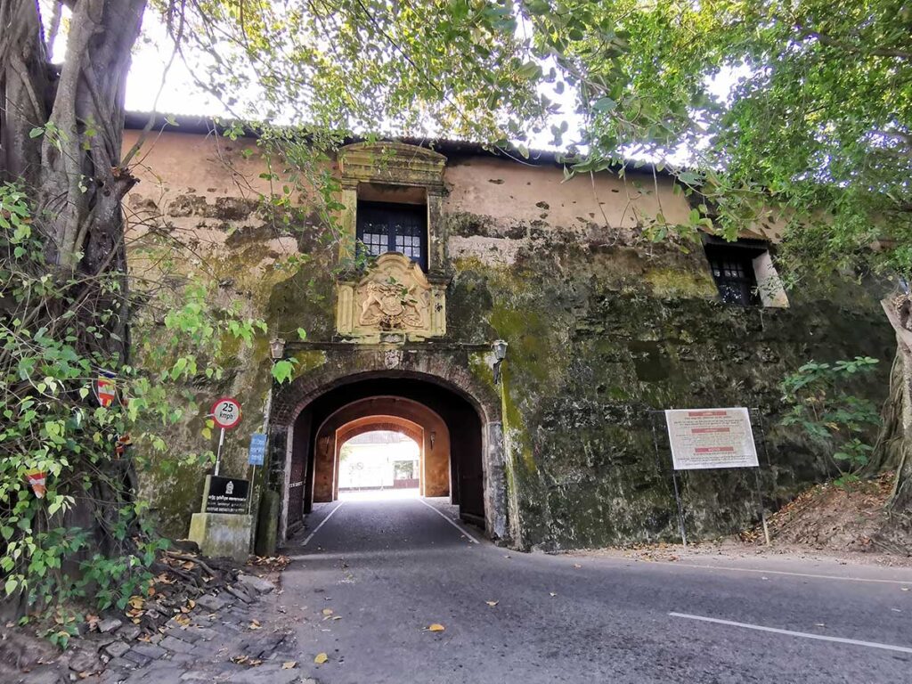
The old outer gate of the Galle Fort – Sri Lanka can be reached, entering the Fort from the road parallel to the beach. The significant feature seen on this massive gate is a plaque carved with the Royal Emblem of Ireland dating back to the period of King George III of England placed after the capturing of Galle by the British. British Crown is held by a lion from its right side and by a unicorn from the left side is displayed on this plaque. The motto of the British Emperor, (Dieu et Mon Droit) meaning ‘GOD’S and MY DOMAIN’ is marked on a strip at the plaque. The Coat-of-Arms of the VOC fixed here was removed and placed above the inner archway. The old gate with this plaque is a reminder of the historical event taking over the administration of the Fort by the British from the Dutch in 1796.
Inner Gate
During the period of Portuguese around 1620, they had built a palisade facing the rampart in front of the Gate. But after the arrival of the Dutch, the entrance was changed and made it to a part of a huge warehouse connecting to the rampart. Emblem of the Dutch East India Company can be noticed above the main entrance passing through the warehouse. Here the name “Dutch East India Company†is represented by the monogram of the VOC. The rooster upon a rock in the picture on top reminds the legend of the discovery of Galle by the Portuguese. At the bottom of the plaque shows the date of the completion of the gate: 1669 AD. This emblem which was formerly at the front face of the Main Gate was fitted upon the inner face by the British.
Maritime Museum

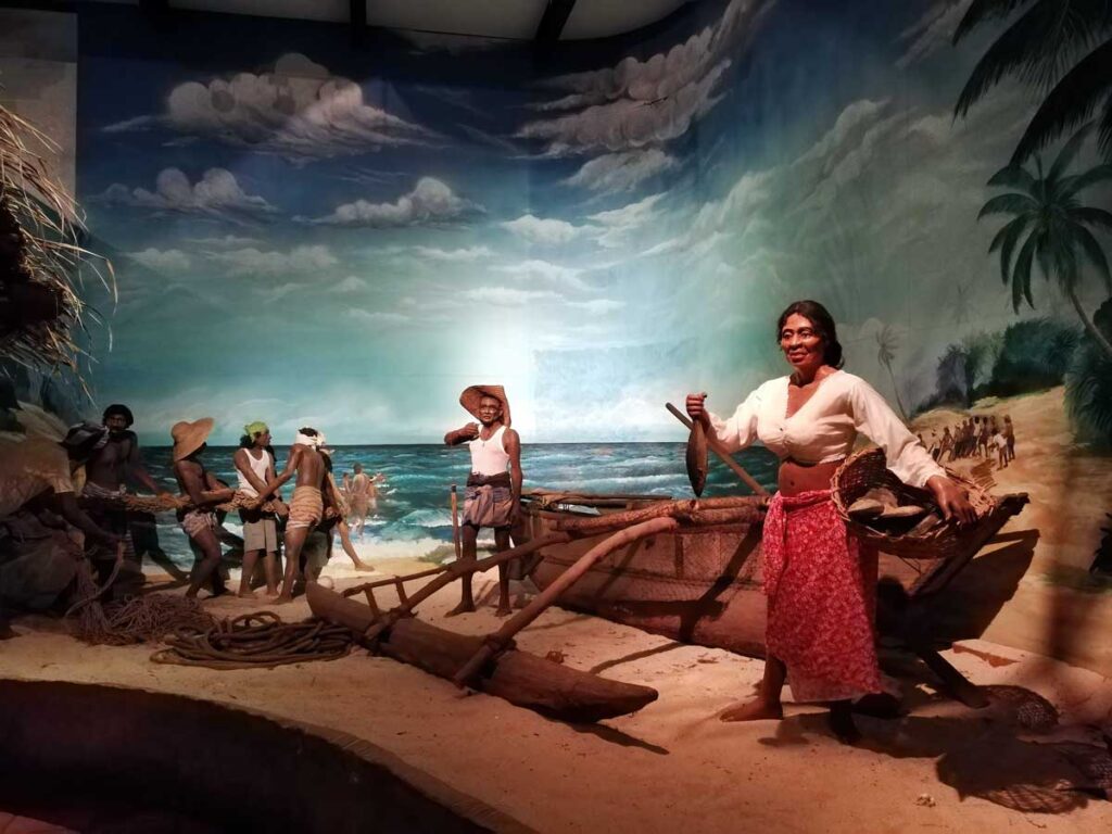
The Maritime Museum in Galle which was established in the year 1992 functions under the Department of National Museums. This museum displays exhibits about the Sri Lankan culture connected with the sea and all the living beings in the marine environment, ranging from tiny single-cell life forms to the largest living being, the blue whale. It displays the habitats of all these beings, including mangroves, salty wetlands, sand dunes, beach, seagrass, and coral. Additionally, it presents various types of boats and water rafts used in the Sri Lankan society from ancient times and also the lifestyle of fishing villages along the coastal area through models and replicas. Due to Tsunami occurred in of 26th December 2004, this museum was almost totally destroyed, and it was renovated and re-opened for public viewing in 2009.
Maritime Archaeology Museum – CCF
Maritime Archaeology Museum operated under the Central Cultural Fund is opened for the public on 4th March 2010 and is situated at the Dutch warehouse of the Galle Fort – Sri Lanka, which was built in 1671. It is the only museum that showcases the marine biological and anthropological aspects of the Southern coast of Sri Lanka. The museum is divided into seven display galleries to exhibit artifacts about the maritime archaeology and history of Sri Lanka. Most of the exhibits comprised of underwater artifacts were collected from Galle harbor following underwater expeditions carried out on the sites of the shipwrecks; The Hercules (1661) and Avondster (1659). The museum exhibits comprise objects, replicas, models, and information on panels and videos that cover a long period of the history of the country which spans from 5000 BCE to the late 19th century CE.
National Museum of Galle Fort
The former New Oriental Hotel was converted to house the National Museum in Galle which was opened for public viewing on 28th March 1986. It is a provincial museum managed by the Department of National Museums. Part of the Building was demolished in 1865 to construct the New Oriental Hotel and as a result, it is difficult to imagine how the original building looked like. The main objective of the museum to protect the social and cultural heritage unique to the Southern Province of Sri Lanka, and also provide education, knowledge, understanding, and entertainment. This museum contains three exhibition galleries; the first gallery depicts the historic Galle Fort – Sri Lanka and the cultural and social heritage of the Southern Province of Sri Lanka, the second exhibits artifacts belonging to the colonial era whereas the third displays the historical relations between China and Sri Lanka.
Governor’s House Galle
Governor’s house was an administrative sub-division of the Dutch known as a Commandement and the chief was the Commander who was always a European. When the British took over possession from the Dutch in 1796, the Commander’s House was converted to King’s House and later to Queen’s House. Over the years maintenance of the building became a burden to the British administration and then sold it at a public auction in 1872 to Clark Spence & co. and later to Walker Sons & co. It again changed ownership and now in the hands of another institution. Above the doorway of the building, a carving of the cock on the rock is mounted with the date 1683. This building has been subjected to numerous alterations in the past two centuries and the original structure is no longer recognizable.
The Dutch Reformed Church
Famously known as the Groote Kerk, the Dutch Reformed Church in Galle Fort – Sri Lanka was built in the year 1755 and is among the most prominent and oldest churches that are still in use on the island. It was constructed on the 4th of July 1752 under the supervision of Abraham Anthonisz. The Church was built, according to a tradition, as a thank offering to God on the birth of a daughter to the Commander of Galle: Casparus de Jong (Lord of Spanbroek) and his wife Geertruyda Adriana Le Grand. Located down Church Street, this ancient church features gables on both western and eastern walls without the tower. This Galle church was constructed on a Portuguese convent and also houses a small well-tended graveyard and crypt within its premises. The church was constructed in the Doric style of the period, similarly to the Wolvendaal Church in Colombo. It is also in the form of a cruciform, only the transepts are shorter. This church is the finest example of this style of churches in Sri Lanka with magnificent gables suitable for a Protestant place of worship.
Churchyard and Tombstones
A churchyard is a holy place where burials took place, and it represents the practice of laying a memorial tablet in the churchyard in memory of the deceased. High-ranking distinguished persons got priority to have their burials closer to the church and the rest received a place within the courtyard. Hardly any natives enjoyed this privilege. The text of the majority of tombstones is in Dutch, composed in a set pattern framed with decorated designs together with the heraldry of the deceased. The hourglass, skull, and crossbones symbolizing the uncertainty of life is the common symbol that can be noticed on almost every tombstone. Underneath the floor covering the whole area of the head of the cross is the burial vault of the church. Here too it was a privilege to have the remains placed in the vault after paying a high fee. The vault is now closed and the last burial that took place in this vault was in 1863.
Anglican Church
The Anglican Church or All Saint’s Church located right across the Commander’s residence was consecrated during the British regime on 21st February 1871 and still holds services today. It is believed that the church was constructed on the site of a former Magistrate’s Court House which existed in the place. This magnificent edifice was designed by Sri Lanka’s most famous architect of the 19th century, James G. Smither. It was built on a basilican plan in a Victorian Gothic Revival style of architecture, modified to suit local climatic conditions. The plan of the Church is cruciform adamantly supported on stone columns and arches carved beautifully in timber. Masonry arches built-in local kabuk and lime mortar. The heavy pews, with carvings of the Jewish Star of David, and the sanctuary are all made from Burmese teak.
Sun Bastion
The main defense works with three bastions on the landside were completed by the Portuguese in 1620 and the one to the south was named after the Roman Catholic Saint, Sao Iago (St. James). Since the Portuguese then had the power in the sea, they were rather cautious about native attacks and expected more protection from the landside than from the seaside. When the Dutch conquered, it was reconstructed and renamed it Sun Bastion on 4th August 1667 by Hester de Solemne, the fiancé of Governor Rijcklof van Goens by firing the cannons stationed here. In 1697, the base of the bastion was further strengthened. By about 1760, there were about 15 canons installed on this bastion. It gives a beautiful view facing south overlooking the natural harbor and Rumassala range of mountains.
Moon Bastion
The central-northern bastion of Galle Fort in Sri Lanka is called the Moon Bastion. The Portuguese had named this bastion as Conceycao, which meant “the pure conception.†The Dutch originally identified it as the Middle Point. The seriously damaged bastion due to the war was reconstructed and renamed in 1667 as the Moon Bastion by Hester de Solemne, referred to in connection with the Sun Bastion. This was the strongest and the largest bastion out of three facing the mainland. By 1760 this bastion was mounted with nineteen cannons. Passing the drawbridge was the Main Gateway from landside which was fixed to this Bastion. On the top of the rampart was a broad path between Sun and the Star Bastion where soldiers might have marched to observe any possible danger up and down from the land.
Star Bastion
Star bastion which is at the northern end was named by the Portuguese as Sao Antonio (St. Anthony’s). The Dutch first named it the Zee Punt (Sea Bastion). In 1667, it was named Star Bastion by the wife of Commander Adriaan Roothaas. On this occasion, the first cannon was fired by the daughter of the Dutch Commander to mark the occasion. By the year 1760, there were about 6 canons installed on this bastion.
Lighthouse

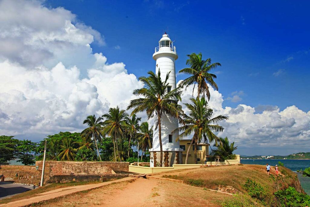
The lighthouse, painted white, was located on the southwest bastion, Utrtecht Bastion, of Galle fort on the western side of Galle Harbor giving it full view of any ships entering Galle Harbour. This was constructed in place of the iron structure formerly fixed at the Flag Rock built in 1848 and burnt down in 1939. The present lighthouse was completed in 1940. The lantern is fixed 92 feet above the water level of the sea and it is built approximately 6 meters (20 ft) above the road level on the ramparts. The original light was furnished with a glass prism lens floating in a bath of mercury (to reduce friction) and was powered by a weight-driven machine.
Hospital Building
The Old Galle Dutch Hospital is one of the oldest buildings in the Galle Fort area dating back to the Dutch colonial era and it has been used for several different purposes, over the years. The hospital was constructed on the site between the Black Fort and Aurora bastion. The Dutch established the Galle hospital to look after the health of the officers and other staff serving under the Dutch East India Company. In 1850, the British used this building first for the office of the Collector of Galle and subsequently the Galle Kachcheri or the Office of the Government Agent of the Southern Province. It is remarkable to note that experiments were conducted against Smallpox in this building as this deadly disease was spreading widely in the vicinity of Galle before smallpox vaccination in Europe was invented. In 2014, the building was converted into a shopping and dining precinct, with the historic architecture having been preserved. The building reflects seventeenth-century Dutch colonial architecture. As many Dutch buildings of the era, the walls are 50 cm (20 in) thick. The structure features massive teak beams. The upper floor can be reached with a wooden staircase. The upper story has a wooden floor. Long open verandas run along the length of each wing of the building.
Law Courts
The Roman-Dutch law was introduced by the VOC to their newly acquired territories in the East including Sri Lanka. Consequently, it became the law of the maritime districts of Sri Lanka in 1656. It was adopted and continued during British times and has become the Common Law of Sri Lanka. The Councils of Justice functioning in the three judicial districts of Colombo, Jaffna, and Galle, each consisted of seven members, appointed by the Governor from the officers of the Company serving in Sri Lanka. The Commandeur of Galle simultaneously exercised the civil and judicial powers. In the 18th century, there was a small building used for the Council of Justice, and the present building was constructed for the purpose just after independence in 1948. It is also known as Court Square since it is in front of Galle’s Magistrates Court Building. It has four white columns in each corner which support a pyramidal clay tile roof in the old colonial Dutch style.
Galle Fort Ambalama
The Galle Fort Ambalama is situated within the open space of Courthouse square at the far end of the Galle Fort. It is a simple structure made up of brick and mortar with four pillars holding its roof. The Ambalama stands on a raised platform but does not have any side walls common among the other brick and mortar ambalamas found elsewhere. The building of the Ambalama was renovated in 2008.


